Many people have a qualitative understanding of the amount of rain that falls, such as, gross, light, moderate, heavy, torrential.Or maybe there was an illustration of a rain gauge in elementary school geography. textbook from the 1980s.
Rainfall is measured by different instruments and methods.The following are some of the common methods of measurement:
1. Rain gauge: A rain gauge is an instrument specifically designed to measure precipitation.The most common type is the cylindrical rain gauge, which consists of a funnel-shaped collector and a graduated glass or plastic container.Rainwater will flow from the collector into the container and the amount of precipitation can be determined by reading the scale.
2. Radar: Weather radar uses radio waves to detect precipitation.The radar emits pulses of electromagnetic waves, which are scattered when they encounter precipitation, and the radar receives the scattered waves.By analyzing the received wave signals, the location, intensity and speed of precipitation can be determined.
3. Satellites: Meteorological satellites can estimate precipitation by observing cloud cover and water vapor content.Satellites carry instruments that measure the water vapor content of the atmosphere and the characteristics of clouds to infer possible precipitation.
4. Automatic weather stations: Modern weather stations are equipped with a variety of sensors to measure various meteorological elements, including precipitation.These automatic weather stations can use pressure sensors, gravity sensors or vibration sensors to measure precipitation.
Each of these methods has its strengths and limitations, and a combination of methods is often used to obtain more accurate precipitation data.
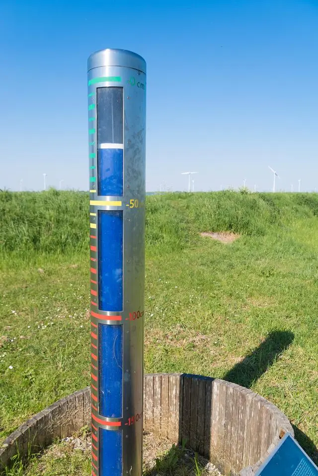
A rain gauge is an instrument used to measure precipitation.It usually consists of a funnel-shaped collector and a graduated container.
The principle of operation is that when rain falls into the collector, it flows into the container.The container has a scale on it that shows the amount of precipitation.Usually, the scale is expressed in millimeters or inches.
Different types of rain gauges have different designs, but most follow a similar principle.They usually have a collector that is cylindrical in shape with an outlet at the bottom to direct rainwater into a container.The containers may be made of glass, plastic or metal and have transparent graduated markings.
The accuracy and reliability of a rain gauge depends on its design and placement.A properly installed rain gauge should be located away from buildings, trees, and other obstacles to avoid interfering with rainwater collection.
By reading and recording the scale of a rain gauge on a regular basis, meteorologists and researchers can obtain data on precipitation amounts to study and analyze weather patterns, precipitation distribution, and climate change.
Weather radar is an instrument that uses radio waves to detect precipitation in the atmosphere.It can provide detailed information on the location, intensity, velocity and structure of precipitation.
Weather radar works by sending pulsed radio waves and detecting the return signals to determine the location and characteristics of precipitation.The radar emits pulsed waves and receives signals reflected back from precipitation objects such as raindrops or snowflakes.The received signals are processed and analyzed to produce images and data on precipitation.
Weather radar uses radio waves in the microwave band, usually S-band (3-4 GHz), C-band (5-6 GHz) or X-band (8-12 GHz).These frequency bands are chosen due to their better propagation characteristics and reflection properties in the atmosphere.
By analyzing the received radar echo signals, meteorologists can determine the location and extent of precipitation areas and calculate the intensity of precipitation.In addition, weather radar can detect weather phenomena such as strong winds, hail and storm vortices in thunderstorms.
Modern weather radars with high resolution and Doppler measurements provide more accurate precipitation data.These data are important for weather forecasting, flood warning, climate research and climate change monitoring.
Meteorological satellites are artificial satellites used to observe the Earth's atmosphere and weather systems.They acquire meteorological data from the Earth by carrying a variety of sensors and instruments and transmit these data back to the ground for use by meteorologists and researchers.
The main principle of operation of meteorological satellites is to use sensors on board the satellites to measure the solar radiation reflected back from the Earth.These sensors can sense electromagnetic waves in different frequency bands, such as visible light, infrared light and microwaves.By analyzing the properties and variations of these electromagnetic waves, meteorological satellites can provide weather and environmental information on cloud cover, temperature, humidity, wind speed, precipitation and pollutants.
Meteorological satellites usually operate in geosynchronous orbits, which means that their orbits are synchronized with the Earth's rotation, allowing the satellites to continuously observe weather changes in the same region.Such synchronized orbits are usually located at an altitude of about 35,786 kilometers, an altitude that ensures that satellites maintain a good line of sight and coverage of meteorological phenomena on Earth.
Data from meteorological satellites are important for weather forecasting, climate monitoring, research on climate change and disaster monitoring.They provide extensive and comprehensive observations of the Earth's atmosphere, helping us to better understand and predict weather and climate phenomena.
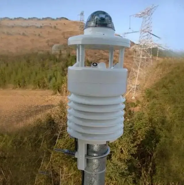
An Automatic Weather Station (AWS) is a device used to measure and record meteorological elements, the operation and data collection process of which is usually automated.These elements include temperature, humidity, barometric pressure, wind speed and direction, and precipitation.
Automatic weather stations typically consist of multiple sensors that are mounted in a fixed location and can continuously measure and record weather data.This data can be transmitted wirelessly or stored in the device's internal memory and can be accessed and analyzed remotely via the web or other means.
The advantage of automated weather stations is their ability to monitor meteorological conditions in real time and provide continuous, accurate data.Compared to traditional manual observations, automated weather stations reduce labor inputs and are able to provide more frequent data updates.This is useful in areas such as weather forecasting, environmental monitoring, climate research and agriculture.
Automatic weather stations are used in a wide range of scenarios, including weather observatories, research organizations, agriculture and aviation.Their data can be used as inputs to weather forecasting models, climate change research and monitoring, disaster warning and farmland management.